Search
Items tagged with: cawx
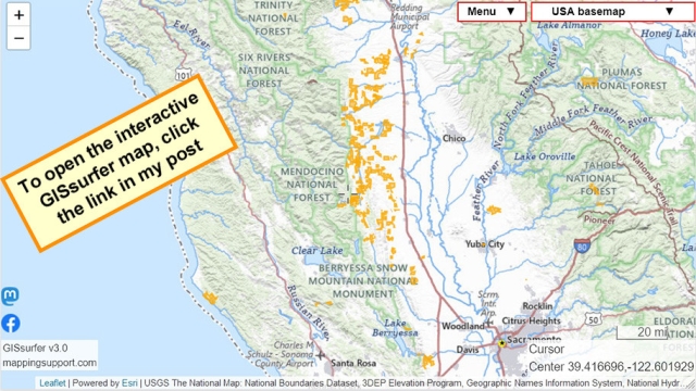
Interactive map showing areas in California where power has been turned off in order to prevent the electric lines from starting wildfires during high wind over the next few days. Some areas will not have power until Sunday afternoon. Click any colored area to see an estimated time when power will be restored.
To search on an address, click Menu > Search.
To convert UTC time to PDT, subtract 7 hours.
#PowerOutage #CAwx
GISsurfer General Purpose Web Map and GIS Viewer | Surf GIS DATA
GISsurfer lets you surf a nearly endless amount of GIS data. Click a layer in the GIS server's table of contents and that data appears on the map.mappingsupport.com
Oh no. Much of the San Francisco Bay Area has a fire weather watch from Thursday morning through Saturday evening because of the forecasted winds and low humidity. This weekend is Pumpkin Festival in Half Moon Bay. If there were to be a fire, traffic would be a huge problem.
forecast.weather.gov/showsigwx…
h/t @visionsofnapa #wildfire #wildfires #CAwx #sfba #SanFrancisco

